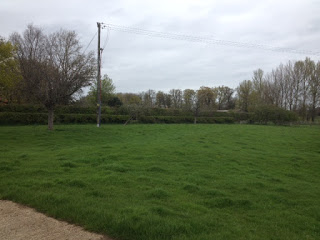
The Cow Lane.
The Cow Lane, c.1960.
This road, leading from Preston bridge to the crossroads, is named after the dairy cows of Lower Farm, which once walked along it from parlour to pasture each day.
The road is a relatively recent
addition to the village landscape. This is evident with a look at the field on
the east side. The ridges and furrows of the ancient open field system are
still clearly visible; a series of very short ridges have been intersected by
the road.
Documentary evidence states that
the road was laid down c.1760 when Preston Lane was relocated. The road into the village once ran closer to
Alscot Park and crossed the river at the bottom of The Ham (see day 3). When James West,
the recent purchaser of Alscot Park, decided to create a deer park in the
1750s, he removed the current road and reinstalled it further away from his house.
James built a new bridge over the
Stour and laid this new section of road,
linking to the Wimpstone and Admington roads and forming a crossroads.


No comments:
Post a Comment